Going up the Country: Tales of Topanga Canyon

Los Angeles is a city and county ringed by mountains where it doesn’t touch the ocean.  With the mountains come canyons, lots of ’em. Some of the most famous declivities are Laurel Canyon, north of Hollywood, Malibu Canyon, and Topanga Canyon. Images from the Los Angeles Public Library give glimpses of life and loss in Topanga Canyon, a winding ravine descending from Woodland Hills in the San Fernando Valley to the ocean between Santa Monica and Malibu. It is contained within the Santa Monica Mountains National Recreation Area (SMMNRA).

Topanga Canyon has a checkered history combining bohemian lifeways, sensational crime, and environmental catastrophes such as fires and mudslides. No doubt the remoteness of the locale and relative inaccessibility contributed to all three. Through it all, folks come to Topanga for its natural beauty and breathtaking views.

Early Days

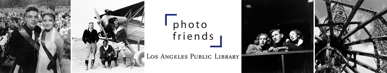
The name Topanga comes from the local native people, generally called the Tongva, who originally occupied the area in close proximity to the Chumash. Despite its remoteness and unsuitability for ranching or agriculture, Topanga Canyon was part of two Spanish land grants in the early 19th century. By the late 19th century enough families were settled in the canyon’s folds to justify a small one-room schoolhouse. The chief occupation was cutting wood to sell to flatlanders. The beautiful canyon and its beach soon began attracting day trippers.

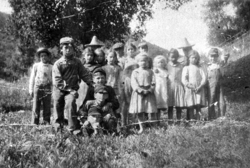
A 1902 photo shows students from the Topanga one-room school. Security Pacific National Bank Collection, Image #00024675. Below, teacher Bessie Greenleaf stands in the school doorway in 1915. The Greenleaf family has deep roots in Topanga. Security Pacific National Bank Collection, Image #00069672.


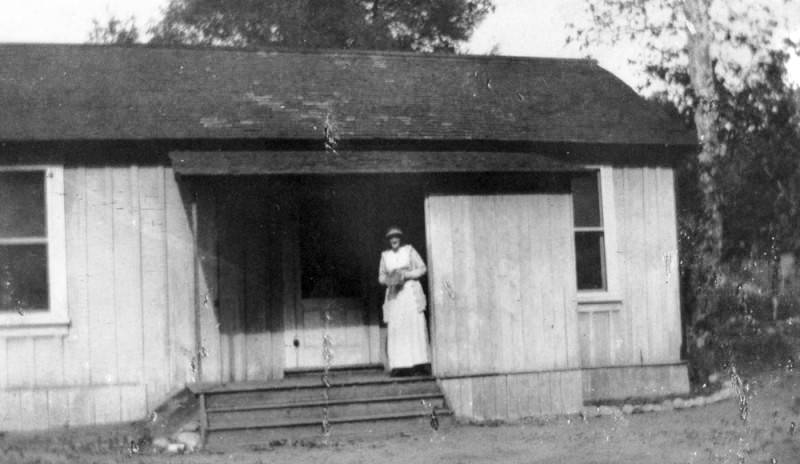
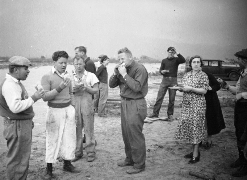
The creek that carved the canyon ends at Topanga Beach. A group of folks enjoy an interlude on the sand, amidst seaweed, about 1898. A small child plays at right, background. Although the picture is labeled “Topanga Beach Picnic,” there is no food visible. The party likely arrived by horse cart and may have traveled over “Old” Topanga Canyon Road which had just opened. Security Pacific National Bank Collection, Image #00069667.

Away from it All

In the 1920s, Topanga attracted Hollywood stars looking for a quick getaway from the pressures of celebrity. Some, like Cecil B. DeMille and actress Pola Negri, built homes here.

Like so many other canyons, Topanga came to be a mecca for artistic types in the 1950s and beyond. The remoteness and natural beauty attracted many musicians. Neil Young recorded his album “After the Gold Rush” in his Topanga Canyon basement. Canned Heat’s Alan Wilson was inspired to write the rock anthem “Going Up the Country” here. Linda Ronstadt and Jim Morrison were frequent visitors. Beach Boy Dennis Wilson had a home nearby. More on that later.

Artists and fringe types still shape the culture of Topanga. The community includes an outdoor theater founded by blacklisted actor Will Geer in 1973, fairs and music festivals, and an annual film festival. A famous nudist colony closed in 2002.

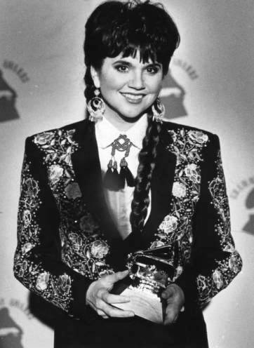
Linda Ronstadt accepts a Grammy in the “best Mexican-American Performance” category, February 22, 1989. Photographer, James Ruebsamen, Herald Examiner Collection, Image #00083175.

The Dark Side of the Canyon

In the spring of 1968 Dennis Wilson of the Beach Boys picked up a couple of cute girls on PCH and brought them to his home just outside Topanga State Park. A day or two later he came home to find his house overrun with a group of strangers — a man named Charles Manson and his “family.” This encounter set off a series of unfortunate events, beginning with the murder of Topanga Canyon musician, Gary Hinman, who had befriended the group. That act was the first (or maybe not!) in a murder spree that took the lives of seven people (and likely more), including actress Sharon Tate and her friends.

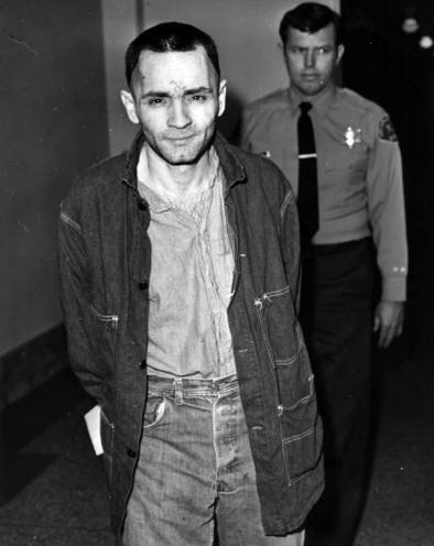
Charles Manson, in a rare shaven appearance, during the penalty phase of his trail in Los Angeles, March 23, 1971.  The swastika he carved into his forehead is visible. Herald Examiner Collection, Image #00020778.

An earlier crime also involved the canyon. In 1951 Valley resident Barney Mapes dumped the bludgeoned body of his estranged wife in the ravine. In an unusual twist for the times, Barney was acquitted on the grounds of self-defense.

Fire and Rain

Wild fires are a perennial problem in the hills of Los Angeles. Topanga is no exception; spectacular and destructive fires have broken out many times.

 The fire in this 1948 image destroyed 25 homes. Herald Examiner Collection, Image #00045944.


Firefighters battle the 1938 fire in Topanga Canyon. Herald Examiner Collection, Image #00045945.


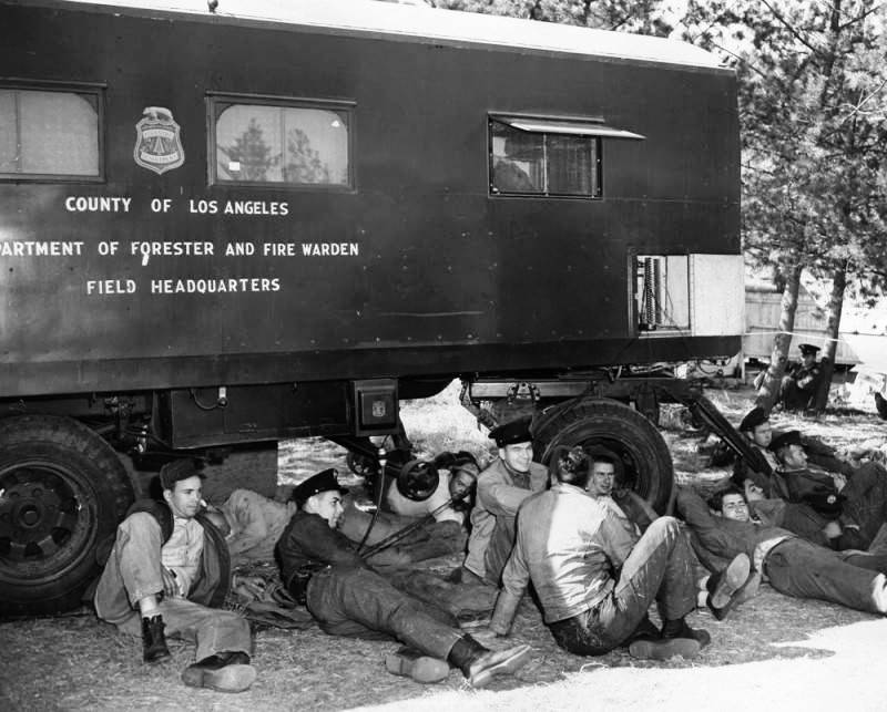
A group of firefighters rest in the shade of their headquarters vehicle in Topanga Canyon, in November 1948. How many do you see? Herald Examiner Collection, Image #00057029.


Women with a child and pets wait to evacuate the canyon in the wake of a 1943 fire which destroyed their home. Herald Examiner Collection, Image #00057132.


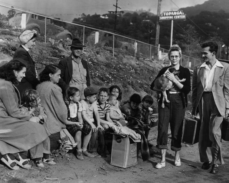
Families fleeing the 1948 fire gather at the Topanga Canyon shopping center waiting for evacuation. Herald Examiner Collection, Image #00057062.

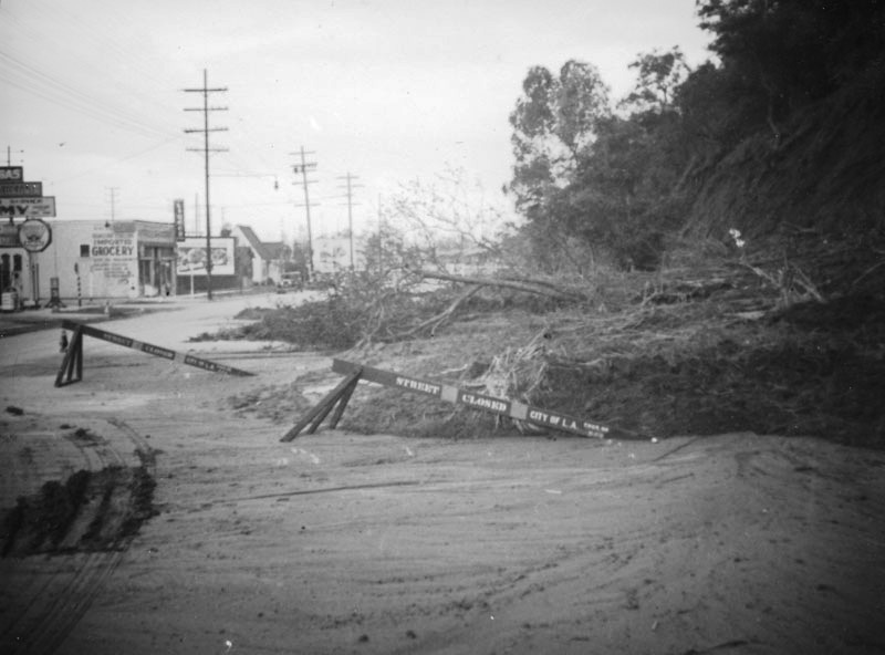
Where there are fires, can flash floods be far behind? Topanga has suffered from repeated cycles of floods and mudslides, sometimes trapping residents for days due to washed out roads. In recent years, mudslides have been an annual occurrence.


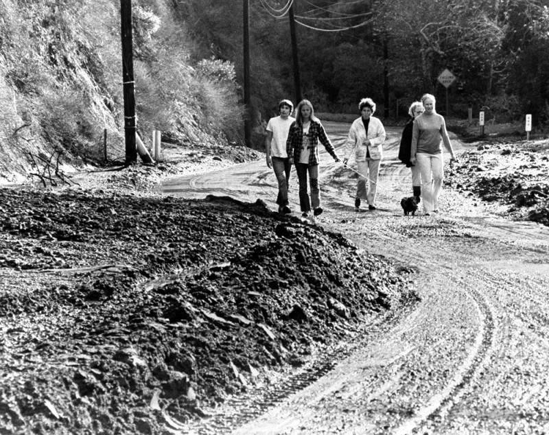
Five people and a dog walk past mounds of muck following a 1973 mudslide that closed the main road for several days. Photographer, E. Bruce Howell, Herald Examiner Collection, Image #00045957.


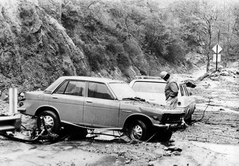
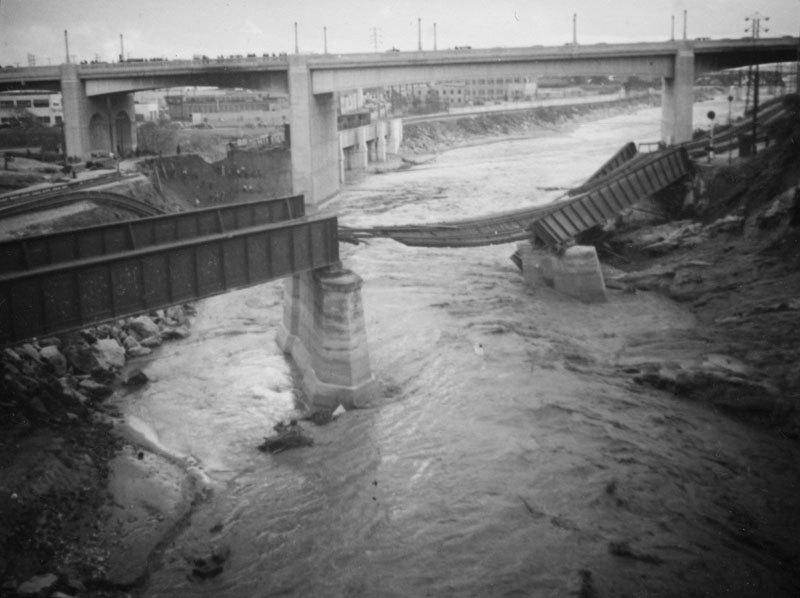
Several cars were washed fifty yards down the canyon in a 1974 mudslide, about a month after the photo above. Photographer, Mike Mullen, Herald Examiner Collection, Image #00045960.

Rocks and fossils: The Ecology of the Canyon

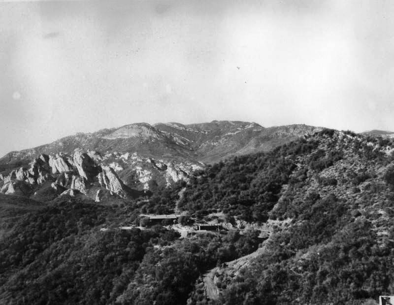
Old Topanga Road (possibly called simply Topanga Road at the time), with Calabasas Peak in the background, in 1937. Topanga Canyon Boulevard, now State Route 27, was put in at about the same time. Works Progress Administration Collection, Image #WPA 147.

Topanga Canyon is a geologist’s dream. Cliffsides contain fossils, everything from scallops to whales, left by retreating ocean waters millennia ago. Sandstone structures, part of what is called the Vaqueros Formation, make dramatic appearances on the hills. Remnants of indigenous culture are found in the many bedrock mortars, man-made holes used to grind food products.

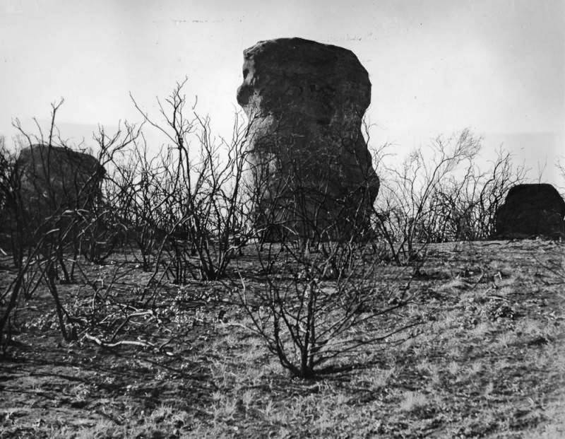
Vaqueros sandstone monoliths stand near Saddle Peak Road in Topanga Canyon, 1937. Works Progress Administration Collection, Image #00030237.

Vaqueros sandstone outcropping, 1936. Security Pacific National Bank Collection, Image #00030364.

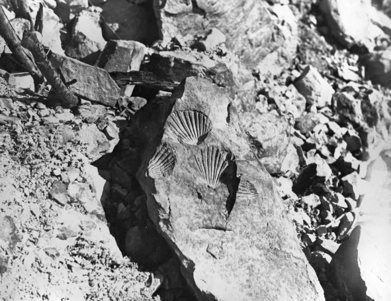
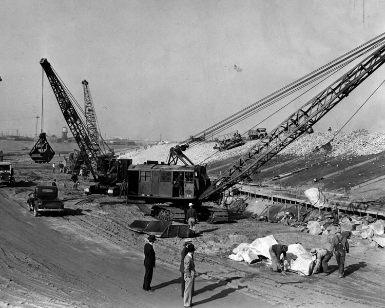
Scallop shell fossils uncovered during road construction. Undated photo, Works Progress Administration Collection, Image #00030359.


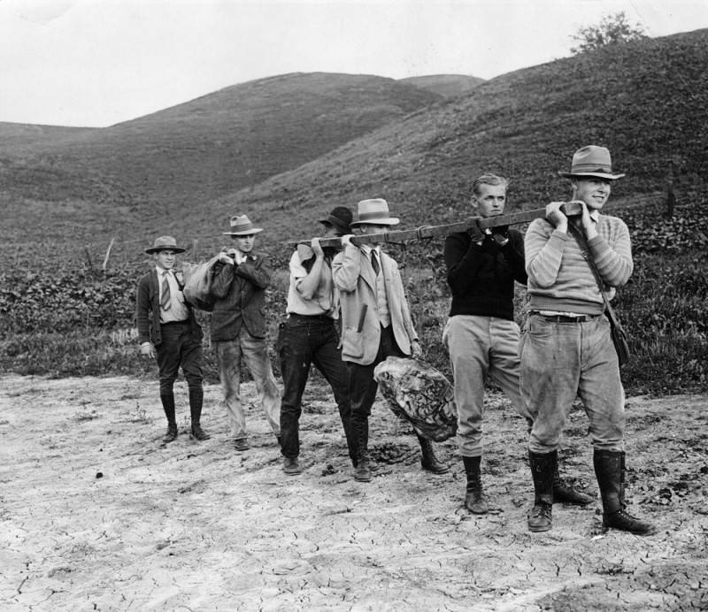
USC Geology students carry a fossilized whale flipper and vertebrae out from a dig in Woodland Hills, circa 1920. The professor in charge, A.J. Tieje, may have been the photographer. Herald Examiner Collection, Image #00071898.


Herman J. Schultheis Collection, Los Angeles Photographers Collection, Image #00097866.

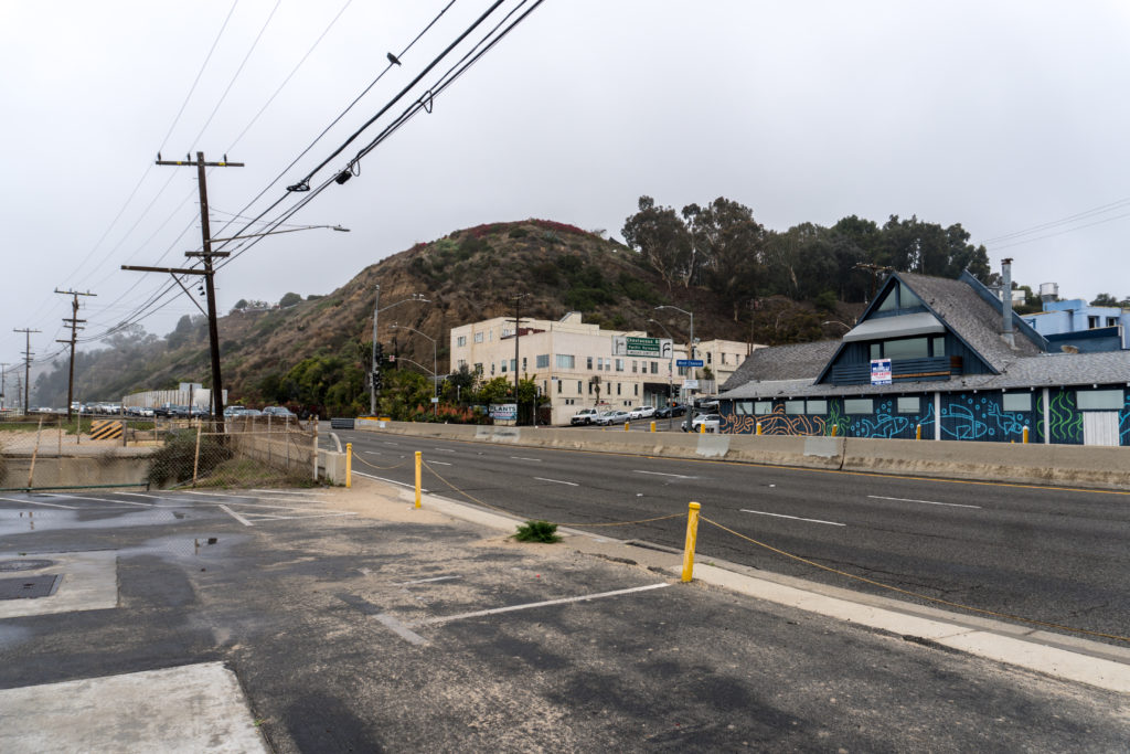
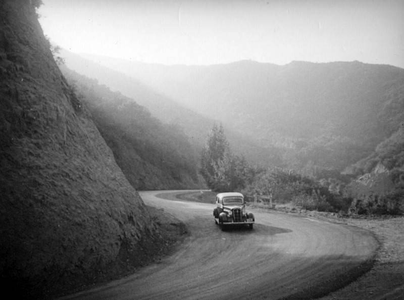
We’ll leave with this magical view of Topanga Boulevard taken by prolific German-born photographer Herman J. Schultheis in or about 1937.

Mr. and Mrs. Schultheis go to Santa Barbara

We have written before about Herman Schultheis, the German-born photographer and jack of all film-related trades. With his wife, Ethel, Herman arrived in Los Angeles in 1937 with high hopes of a career in the film industry. He did find work with Disney where, for a few short years, he had a hand in the special effects magic used to create Fantasia, Pinocchio, and other animated classics. Today he is best remembered for several secret notebooks he put together documenting the processes used to create that magic, as well as for his mysterious disappearance in a Guatemalan jungle in 1955. Following the death of Ethel in 1990, conservators found a trove of thousands of photographs in the Schultheis home in the Los Feliz neighborhood. Documenting a wide swath of life in the Southland, these snapshots were deeded to the Los Angeles Public Library. Nearly 6,000 have been digitized. A handful are presented here. All contemporary photos are by the author.

Sometime in 1938 Herman and Ethel made a trip to Santa Barbara, that charming town up the coast from Los Angeles along El Camino Real (now the 101 Freeway). It may have been a day trip, or perhaps the couple spent the weekend. The trip was, no doubt, a chance for the Schultheises to relax and indulge their favorite activities — exploration and photography. Without realizing it, they were also documenting the newly reinvented Santa Barbara, now fully committed to honoring, and capitalizing on, its Spanish colonial roots.


The Mission Santa Barbara, church front. Herman J. Schultheis Collection, #00097380.


The Mission Santa Barbara: this photo shows the northern flank of the colonnaded Mission , with a fountain and lavanderia in front. The washing trough was built by Chumash Indians in 1808, and was fed by an aqueduct system bringing water from Mission Creek. Schultheis Collection, #00097372.


Schultheis image #00097377 shows Ethel Schultheis peering into the fountain where she is reflected alongside one of the mission’s iconic twin bell towers.


Colonnade at the Queen of the Missions. Schultheis Collection, #00097375.


Our contemporary photo shows the original lavanderia still in place in front of the mission. The mission’s second bell tower is obscured by the tree. The bear’s head spout is a re-creation, but may have been original at the time Schultheis took his photo. The mountain lion spout, pictured below, is an original Chumash carving.


Herman and Ethel visited the splendid Santa  Barbara Courthouse. This working county courthouse was built in the late 1920s in Spanish Colonial Revival style. Following a devastating earthquake in 1925, the city elders decided to rebuild much of the town in this style, creating what to this day appears as a white washed, red-tiled Spanish theme park on the California coast.

The front entryway of the massive courthouse is flanked by the sandstone fountain sculpture entitled “Spirit of the Ocean.” According to a history of the courthouse*, two local “children,” brother and sister, acted as models for the sculptor, Ettore Cadorin. Schultheis Collection, #00036425.


The contemporary version appears much the same, but in fact is a re-creation put in place in 2011, as the original sandstone had deteriorated. In addition, despite the watery appearance of the green tiles, there is no water in the fountain, a casualty of California’s persistent drought.


The monumental entrance to the courthouse. Schultheis Collection, #00038217.


Courthouse from the interior courtyard and sunken garden, showing the entry way from the opposite end. Schultheis Collection #00038205.


Our contemporary photo doubles the Schultheis snapshot above. The Schultheises may well have taken in the panoramic view of Santa Barbara afforded from the upper deck of the clock tower, although no photos from that location have been found.


The Casa de la Guerra, Schultheis Collection, #00097366. The silhouette of a protruding Spanish-style balcony can be seen at upper left. Schultheis may have taken this overhead shot from another balcony.

Once a large hacienda, with many outbuildings and a tower room, the Casa de la Guerra is much reduced in size and circumstance, but is now managed as a museum by the Santa Barbara Trust for Historic Preservation. Built by a commandante of the Santa Barbara Presidio, José Antonio de la Guerra y Noriega (1779-1858), the Casa was a center of social activity in the young pueblo through much of the 19th century.

The Casa de la Guerra today.

The El Paseo shopping arcade, established during Santa Barbara’s Spanish Colonial Revival in the 1930s, surrounds the Casa on all sides except its front. Schultheis and his wife no doubt explored the charming alleys and plazas of this planned attraction. The particular alley pictured above was dubbed “Street in Spain.” Schultheis Collection, #00097367.


Schultheis took a number of photos of an area the cataloger dubbed “Santa Barbara Square.” In fact, this is the area called Plaza de la Guerra. Comparing the photo above with current photos it is clear that this is the Oreña Adobe, just down the block from the Casa de la Guerra and across the street from Santa Barbara City Hall. Built in the 1850s, the Oreña Adobe is now home to the Downtown Santa Barbara Association. Schultheis image #00097370.


The Biltmore Hotel, Montecito, Schultheis Collection, #00097333.

The Schultheises were clearly taken with the architecture and landscape of Santa Barbara. There are many photos in the collection of architectural detail. Schultheis took photos at both the posh Biltmore Hotel (now a Four Seasons resort) in Montecito and the nearly as grand Hotel Vista Mar Monte (now the Hyatt Centric Santa Barbara), although it is doubtful that the couple stayed at either. Money was tight. Herman had just started work at Disney after a lengthy period of unemployment.

The Hotel Vista Mar Monte, Schultheis Collection, #00097347.


A picnic under the palms, Schultheis Collection, #00097356. The ladies may be at a beachfront park on Cabrillo Boulevard. Ethel Schultheis is at left. One of the women at right may be her mother, Marie Wisloh, who, along with her husband Theodore, visited her daughter about this time.


Channel Drive, Schultheis Collection, #00097337.

The photos Herman took of the historic buildings and hotels are not his best work. There was no plan to publish them or use them to inspire his work at Disney. However, they nicely reflect a happy weekend for the couple.


*Gebhard and Masson, The Santa Barbara County Courthouse, 2001.

Water and Power: the 1938 Los Angeles Flood

Eighty years ago this month the greater Los Angeles area was hit by two massive storms resulting in a “50-year*” flood event. Rainwater from the sky combined with torrents cascading down mountain canyons to overwhelm the Los Angeles, San Gabriel, and Santa Ana Rivers, along with numerous smaller rivers and creeks. The resulting floodwaters inundated much of the Southland, swamped low-lying land with mud, and caused widespread destruction of homes,  farms, bridges, and power lines. At least 115 people died. Several small towns east of Los Angeles were wiped off the map. As a result of the catastrophe, much stronger flood control measures were adopted and the character of the Los Angeles basin was forever changed.

*a flood of a size to be expected only once in fifty years.

A man and his camera

Herman Schultheis was a young German immigrant and photographer who, with his wife, moved from New York to Los Angeles in 1937 to find work in the studios. By early 1938 he had obtained a position at The Walt Disney Company, at the old Hyperion Avenue Studios close to the course of the Los Angeles River in Silver Lake. Schultheis is remembered for his contributions to special effects photography at Disney, including work on the films Pinocchio and Fantasia. He is also known for a mysterious notebook he kept detailing some of the processes used on these films and for his equally mysterious death in the jungles of Guatemala in 1955. But we’ll save those stories for another day.

When the waters came down, Schultheis was on the scene with camera in hand. In fact his job at Disney began just as the first of the two storms hit. The photo collection of the Los Angeles Public Library contains nearly 6,000 digitized Schultheis photos, many of them of the receding flood waters and the damage they caused. As still photos, they only begin to tell the tale of the disaster. (All photos by Herman J. Schultheis, 1938, unless otherwise indicated.)

We have attempted to recreate some of Schultheis’s shots. The “now” photos clearly show the effects of both flood-control efforts and new transportation corridors on the landscape of a city.

This pair of photos show the Arroyo Seco in Highland Park at the point where the East Avenue 43 Bridge was completely washed out by floodwaters and the adjacent roadbed heavily degraded. The second photo must have been taken after the bridge debris had been cleared. Schultheis Collection, #00099605 and #00099603.


In 1939 a new bridge was dedicated — one that extended not only over the Arroyo, but also over the newly built Arroyo Seco Parkway (Pasadena Freeway), the first freeway in California. The Arroyo Seco itself, on the right, has been channelized in concrete, as was the entire L.A. River system following the 1938 flood.  The bridge is immediately adjacent to the Lummis Home and Garden, the subject of another LAPL Photo Friends blog post. Photo: Alan Humphrey, 2018.


Riverside Drive, sandwiched between the Los Angeles River and Elysian Park, took a massive hit from flooding and mudslides. Schultheis Collection, #00082329.


Roughly the same spot as above. The Golden State Freeway, to the right, makes it impossible to get Schultheis’s angle. Our “best guess” intersection is Riverside and Fernleaf, facing southeast. Photo: Alan Humphrey, 2018.


The Lankershim Bridge across the Los Angeles River was destroyed except for a 20-foot stretch on the south side. Schultheis Collection, #00099542.


Four of Schultheis’s flood photos feature a dachshund, in spots ranging from El Monte to North Hollywood. Could this perhaps be the photographer’s own dog on the stub of the Lankershim Bridge? Across the channel, Lankershim and Cahuenga Boulevards come together in a vain attempt to cross the river. Schultheis Collection, #00099539.


The new Lankershim span. The trickle of water that is the Los Angeles River can be seen in its concrete channel. Photo: Alan Humphrey, 2018.


The Southern Pacific railroad bridge at Dayton Avenue (a portion of Figueroa Street) hangs twisting over the swollen Los Angeles River along with railroad tracks. The Figueroa Street Viaduct, only just constructed as part of the planned Arroyo Seco Parkway, is in the background. Schultheis likely took this picture from the deck of the Dayton Avenue traffic bridge, at that time called the Riverside-Dayton Avenue Bridge. Clear as mud? Schultheis Collection, #00082304.

Multiple new transportation corridors, including the Golden State Freeway, make it impossible to safely capture the low-lying railroad bridge today. The old Figueroa Street Viaduct, now part of the Arroyo Seco Parkway, in the background, appears substantially the same as in the historic image. The bridge in the foreground was newly built in 2017, replacing the old Dayton Avenue traffic bridge, or the Riverside-Dayton Avenue Bridge, or the Riverside Drive Bridge. In sum, the current bridge is the fourth iteration of a bridge at this point.  Photo: Alan Humphrey, 2018.


A massive landslide swept down on Hyperion Boulevard in the Silver Lake neighborhood (and very close to the old Disney Hyperion Avenue Studios.) Amazingly the houses in the photo survived where many elsewhere were destroyed. The contemporary photo below shows that both the center home and the one to its left remain to this day. Schultheis Collection, #00082317.


A lesson learned. The developer constructing new homes on Hyperion Avenue is buttressing the hillside. Photo: Alan Humphrey, 2018.


Pacific Coast Highway (then called the Roosevelt Highway) suffered heavy damage from the floodwaters. Crews work to stabilize the roadbed where Santa Monica Canyon Creek and Rustic Creek come together. Herald-Examiner Collection, photographer unknown, 1938, #00028399.


Our contemporary photo shows that the large building against the hillside still stands. A portion of the concrete creek channel can be seen on the beach side of the highway.  The sign announcing the community of Huntington Palisades is gone and the hillside appears somewhat diminished. Today a pedestrian tunnel connects the cliff side to the beach. Photo: Alan Humphrey, 2018.


Schultheis and his wife visited a hog farm in El Monte where flood waters left behind a muddy mess and destroyed farm structures. Here Schultheis photographed relief workers on a break. Schultheis Collection, #00099523.


A few folks didn’t mind the muck. Schultheis Collection, #00099521.


After the deluge

In the wake of the 1938 flood, authorities went to work in earnest to prevent another disaster; the U.S. Corps of Engineers got into the act, channelizing the Los Angeles River into concrete troughs. In addition, bridges were rebuilt, flood control dams constructed, and Los Angeles’s famous deep street curbs installed. But recent extreme weather events in the Southland raise the question: is it enough?

Men begin the job of mucking out the Los Angeles River in North Hollywood. Schultheis Collection, #00099556.


Later stages of the flood control project undertaken by the Army Corps of Engineers, south of downtown Los Angeles. Boulders are being placed in the river channel. Herald-Examiner Collection, #00045099. December 2, 1938.


As for our photographer — Herman Schultheis was a talented and ambitious man who struggled to find a toe-hold in “the industry.” After only three years at Disney he was asked to move on. Disney had money concerns, and Herman’s German citizenship as war loomed may not have helped matters.  In 1955 Schultheis took his camera to Guatemala to photograph the ruins at Tikal and disappeared. Some 18 months later his remains were found in the jungle. In many ways his life mirrored that of the down and out songster (minus the 747):

Got on board a westbound seven forty-seven
Didn’t think before deciding what to do
Oh, that talk of opportunities, TV breaks and movies
Rang true, sure rang true
Seems it never rains in southern California
Seems I’ve often heard that kind of talk before
It never rains in California, but girl, don’t they warn ya?
It pours, man, it pours
(Albert Hammond)


Schultheis with camera on a movie set — possibly Warner Brothers’ film The Sea Hawk (released 1940). Photographer unknown, but possibly Ethel Schultheis. Schultheis Collection, #00101367.

Sources include: